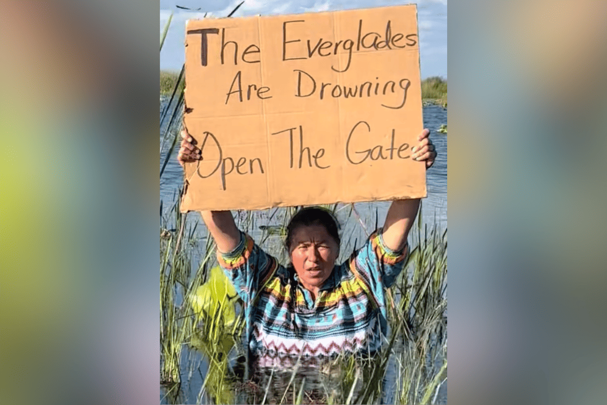
Miccosukee Tribe member warns of Everglades flooding after discharges from Lake Okeechobee

MICCOSUKEE, Fla. – Betty Osceola, a member of the Miccosukee Tribe born in the Everglades, highlighted repercussions of purported flooding in the Everglades Agricultural Area after an order made by Congress to the U.S. Army Corps of Engineers to release Lake Okeechobee discharges south into its basin.
Due to the flooding, videos have allegedly surfaced, documented by Osceola, showing the Everglades with extensive flooding damage. Additional video can be found here.
“While the Central Everglades was too full, the Southern Everglades could have taken more water but for a constraint in place that prohibited more water being moved south, unless an emergency deviation took place,” Osceola said in a Facebook post. “Thankfully, with public pressure myself and other helped create, an emergency deviation was issued, and more water was allowed to flow southward into Everglades National Park in greater quantities.”
Osceola hoped claims were simply a “case of not understanding.”
“I guess when some people make the claim the Everglades are being intentionally starved of water by intentionally not allowing releases of Lake Okeechobee water to make its way south to the Everglades don’t understand the full complexity, and scenario of the dynamics of the issues – or they are intentionally misleading on purpose,” Osceola continued.
The Everglades, covering 1.5 million acres, gets direct rainfall in addition to water flowing south from parts of Central Florida into Lake Okeechobee. The largest wetland system in the U.S., it receives around 60 inches of rainfall per year on average.
A tropical habitat with a diverse ecosystem, Congress established the Everglades as a National Park in 1934.
“If the Central Everglades is too full from direct rainfall, it doesn’t have room to receive more water from the north, as it was this past year and into the beginning of 2024,” Osceola said.
Lake Okeechobee, located in central-southern Florida, was initially held at higher levels through the direction of the Corps. The initial operation intended to avoid releasing water east and west to the Caloosahatchee and St. Lucie Rivers, as well as south into the conservation areas.
One Florida Foundation Director Nyla Pipes expressed to Florida’s Voice that the Corps currently operates under LORS 2008, short for Lake Okeechobee Regulation Schedule 2008.
“They let the lake get above 16 feet, and then they reached a spot where they realized – with the coming weather, everything coming down from the Kissimmee, and the fact that we are heading into rainy season – it was time to get the lake a little lower,” Pipes said.
Covering 730 square miles, Lake Okeechobee is the largest lake in the southeastern United States. It also is the third largest freshwater lake, behind Lake Michigan and Iliamna Lake, in the country.
Moreover, Lake Okeechobee, around 40 miles northwest of West Palm Beach, is situated at the northern edge of the Everglades wetland region.
“There does need to be more water sent south, but it needs to be sent south clean and in the right times and at the right amounts,” Pipes said. “It’s a very complex conversation that people tend to oversimplify.”
According to Osceola, more efficient water delivery decisions are being explored through a conditions based system. She also called the discussions a chance at being “reactionary instead of proactive.”
“The issues are very vast and complicated and is going to take multiple ways of solving the issues,” Osceola said. “One industry can’t be blamed for all the problems. It’s a multifaceted issue that is going to need a multifaceted approach.”


